The AquaMaps Virtual Research Environment
Contents |
Description
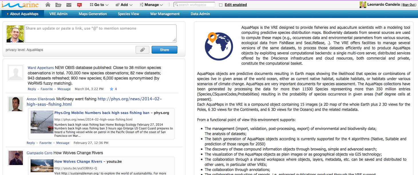
The AquaMaps Virtual Research EnvironmentA ''system'' with the following distinguishing features: ''(i)'' it is a Web-based working environment; ''(ii)'' it is tailored to serve the needs of a Community of Practice; ''(iii)'' it is expected to provide a community of practice with the whole array of commodities needed to accomplish the community’s goal(s); ''(iv)'' it is open and flexible with respect to the overall service offering and lifetime; and ''(v)'' it promotes fine-grained controlled sharing of both intermediate and final research results by guaranteeing ownership, provenance, and attribution. is for providing fisheries and aquaculture scientists with facilities for producing and accessing species predictive distribution maps showing the likelihood that a certain species or a combination of species will live in specific regions or areas.
URI: https://portal.i-marine.d4science.org/group/aquamaps
Functionality
The main facilities this VREVirtual Research Environment. offers are:
- AquaMaps Data Administration: to enable VREVirtual Research Environment. Data Managers to produce new versions of the AquaMaps datasets (the datasets exploited by the AquaMaps service to produce species distribution maps). Such datasets include HSPEC (an estimation of species occurrence by species and cell), HSPEN (an envelop representing the tolerance of species wrt environmental parameters), and HCAF (environmental parameters by cell) while the algorithms that can be used to produce new versions of them include Linear or Parabolic Interpolations, Native and Suitable Range, Native 2050 and Suitable 2050 Range;
- AquaMaps Maps Generation: to enable users to produce species and biodiversity predictive distribution maps. The portlet make it possible to select the set of species to analysed, to define the data to use and to submit massive generation tasks leading to the production of AquaMaps objects representing the maps eventually including their GIS version;
- Search: to enable users to discover information objects over a number of collections via a keyword-based Google-like search, an advanced query consisting of diverse criteria per field, or via browsing. Collections are either materialised set of information objects or virtual collections resulting from the interaction with existing data sources (e.g. via harvesting or via query);
- Documents Workflow facilities: to enable users (i) to define complex workflows (including steps and roles users should have to perform certain steps) governing the production of gCube documents, (ii) to instantiate such workflows to actual documents to be collaboratively created, and (iii) to monitor workflow execution;
- Workspace: to enable every user to store and organise the information objects he/she is interested to work with. In addition to that, the user is allowed to collaborate with other users by sharing objects and messages;
- VREVirtual Research Environment. Management: to enable authorised users (i.e. VREVirtual Research Environment. Managers) to manage other users using or willing to access the VREVirtual Research Environment.. VREVirtual Research Environment. Managers can (i) authorise users in accessing the VREVirtual Research Environment., (ii) assign or withdraw roles to users, (iii) remove users, and (iv) send a communication to the current users.
Data
The main datasets that are available via the services hosted by this VREVirtual Research Environment. include datasets needed to the AquaMaps algorithm (i.e. HSPEC, an estimation of species occurrence by species and cell; HSPEN, an envelop representing the tolerance of species wrt environmental parameters; and HCAF, environmental parameters by cell), time series graphs produced by FAO (aquaculture, capture, production, and trade), fact sheets produced by FAO on introduced species and cultured aquatic species, maps produced by FAO on country, Current National Legislation Overview (NALO) and National Aquaculture Sector Overview (NASO).
Software
- (DONE) gCube 2.7.2 (December '11);
- (DONE) gCube 2.7.3 (February '12);
- (DONE) gCube 2.8.0 (March '12);
- (DONE) gCube 2.8.1 (April '12);
- (DONE) gCube 2.9.0 (June '12);
- (DONE) gCube 2.9.1 (August '12);
- (DONE) gCube 2.11.0 (October '12);
- (DONE) gCube 2.12.0 (February '13);
- (DONE) gCube 2.13.0 (March '13);
- (DONE) gCube 2.14.0 (May '13);
- (DONE) gCube 2.15.0 (June '13);
- (DONE) gCube 2.16.0 (July '13);
- (DONE) gCube 2.17.0 (December '13);
- (DONE) gCube 2.17.1 (December '13);
- (DONE) gCube 3.0.0 (March '14);
